
The final purpose was in fact to realize an extended documentation activity of the site, through the use of different techniques, useful for expanding and deepening the general knowledge of the Bay.

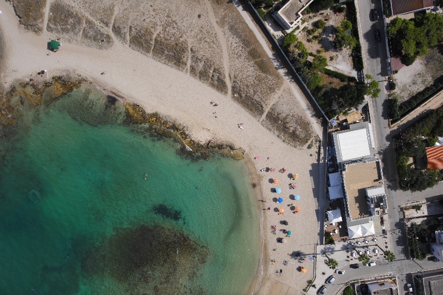
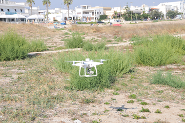
Thanks to the collaboration with the Polytechnic of Turin, through the Geomatics Laboratory of the Department of Architecture and Design and the Department of Engineering Environment - Territory and Infrastructures, it was possible to carry out the topographic relief of the “dei Camerini” Bay and to perform drone shots for the UAV (Unmanned Aerial Vehicle) survey, aimed at creating the 3D model of the Bay. By carrying out subsequent flights with the drone and using markers (signals) positioned on the mainland, in fact, photogrammetric shots of the entire Bay were taken. For the documentation of the submerged archaeological finds, photogrammetric shooting techniques for the underwater relief were tested, both through the use of underwater cameras by an operator, and by specifically testing the operation of a submarine ROV (Remotely Operated Vehicle).