
/ SO 2.1
Monitoring Sea-water intrusion in coastal aquifers and Testing pilot projects for its mitigation
START DATE
01.01.2019
END DATE
30.06.2022
TOTAL BUDGET
€ 2.598.608,61
SPECIFIC OBJECTIVE
Improve the climate change monitoring and planning of adaptation measures tackling specific effects, in the cooperation area
LEAD PARTNER
University of Padova - Department of Civil, Environmental and Architectural Engineering
TARGET GROUPS
- Local
- Regional and national public authorities and related entities
- Universities and research institutes
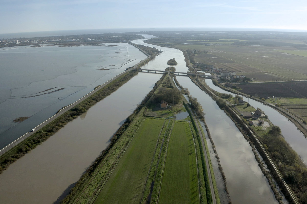
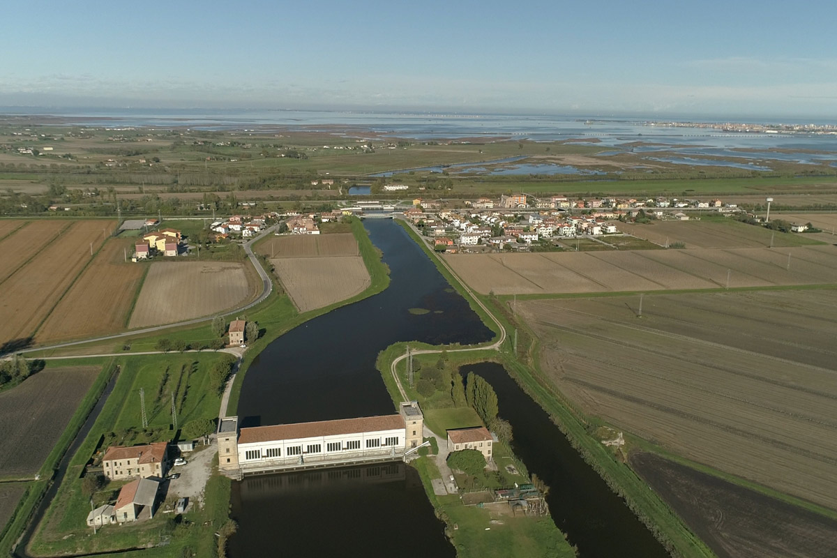
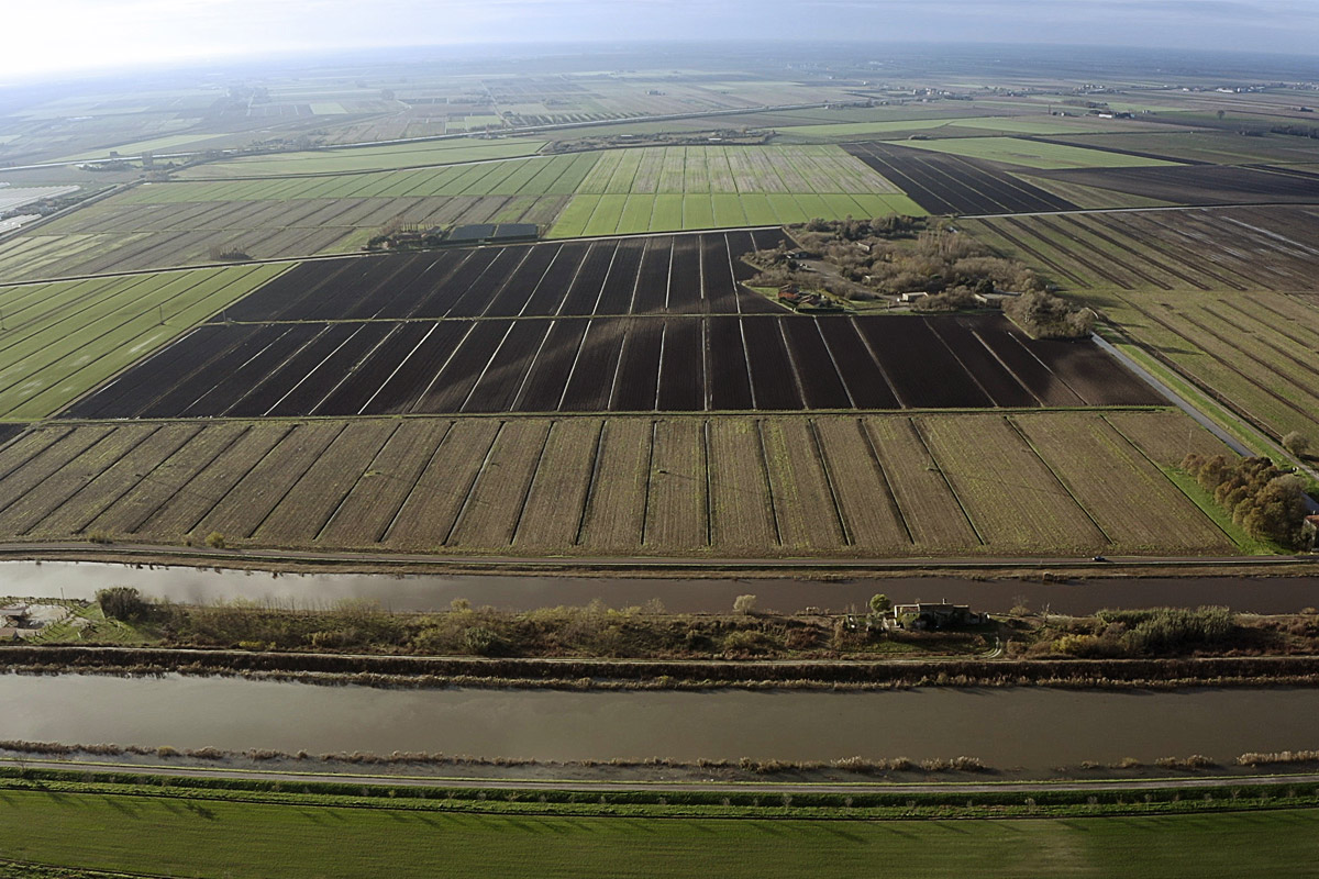
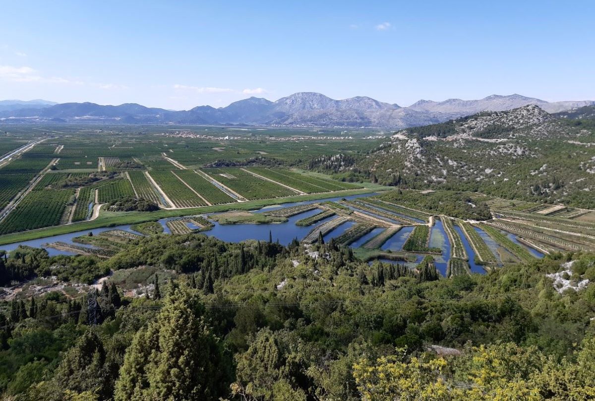
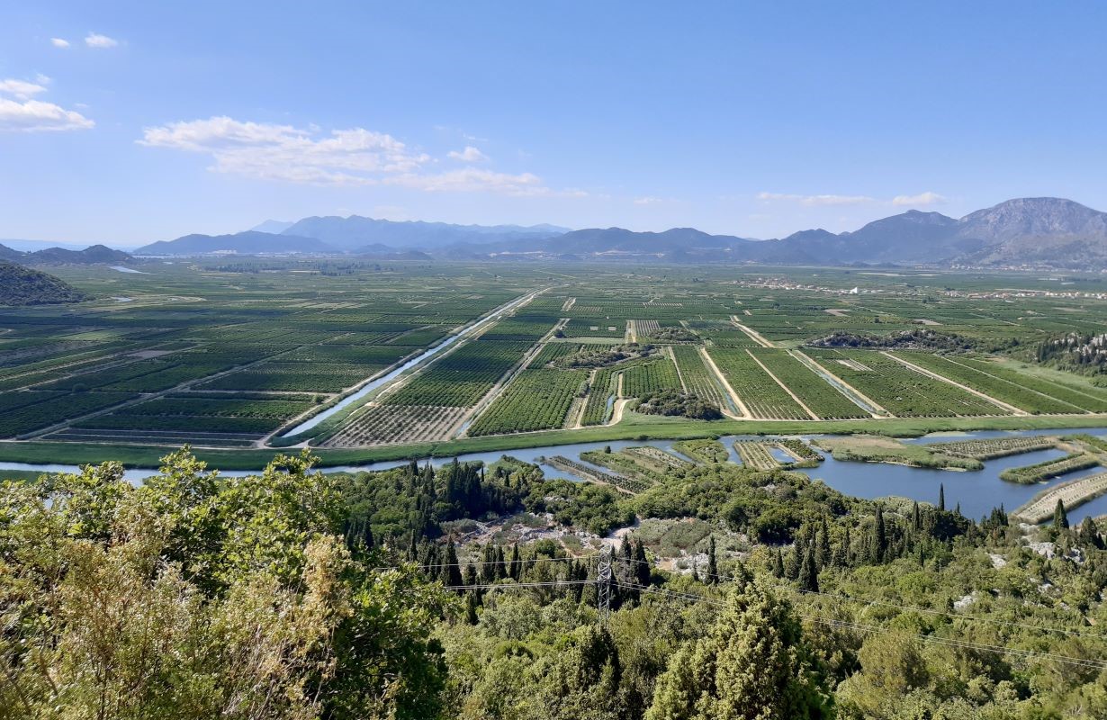
The main objective of MoST is the monitoring of the seawater intrusion in specific regions of the in northern Adriatic coasts of Italy and Croatia to assess its relevance, and suggest/test appropriate countermeasures. In addition, the project expects to improve the capacity in transnationally tackling saltwater contamination vulnerability and the preservation of strategic fresh water resources in coastal areas.
PARTNERSHIP
LEAD PARTNER

University of Padova - Department of Civil, Environmental and Architectural Engineering
VIA VIII FEBBRAIO 1848 N 2
Padua - Italy
https://www.dicea.unipd.it/most
Research and teaching at the Department deal with applied science in the fields of artificial and natural environments. The focus is on technological innovation and advances in basic knowledge through theoretical, experimental and computational approaches, with the development of mathematical and numerical models. Research, with laboratories, and graduate education programmes, include among other activities: water resources, riverine, estuarine and coastal dynamics.
Contact person: Paolo Salandin
E-mail: paolo.salandin@unipd.it
PROJECT PARTNER

National Research Council – Institute of Geosciences and Earth Resources (CNR-IGG)
CNR is the largest public research institution in Italy, the only one under the Research Ministry performing multidisciplinary activities. The Institute of Geosciences and Earth Resources (IGG) is devoted to the interdisciplinary study of the Geosciences and deals with the conservation, management and sustainable use of geological and natural resources, the estimate monitoring and reduction of geological and environmental hazards and estimate and mitigation of the risks induced by global change
Contact person: Luigi Tosi
E-mail: luigi.tosi@igg.cnr.it
PROJECT PARTNER
Land Reclamation Authority Adige Euganeo
Land Reclamation Authority Adige Euganeo is operating in a complex and hydraulically fragile territory of 119.955 ha, 20.000 ha of them are below the seal level. It operates and controls functioning and maintenance of the hydrographic network, which extends for 1.852 kilometres, and is regulated by 62 pumping stations with 162 water pumps, for a total flow rate 272 m3/s, about 300,000,000 m3/year. It provides water for irrigation necessary to thousands of farms, also using pipeline networks
Contact person: Giuseppe Gasparetto Stori
PROJECT PARTNER
Veneto Region - Soil Defence Regional Directorate
https://www.regione.veneto.it/web/guest
The Soil Defence Directorate deals, among other activities, with planning, programming and monitoring of soil and coastal defence measures; hydraulic safety planning and hydrogeological instability protection, as water resources conservation and flooding prevention; works for coastal defence and redevelopment of the coastline; geologic and geothermal planning,quarry and mine activities planning, geologic risk prevention and planning; control and surveillance on land reclamation authorities.
Contact person: Valentina Bassan
PROJECT PARTNER
Croatian Waters
Croatian Waters have extensive experience in accession negotiations for EU membership as well as experience in the transitional process and implementation of water directives (Water Framework Directive, WFD); traditionally manage water resources and, as the leading national institution, is responsible for all aspects of water management in Croatia, have extensive experience in the WFD implementation and development of RBMPs.
Contact person: Stjepan Kamber
E-mail: Stjepan.kamber@voda.hr
PROJECT PARTNER

University of Split - Faculty of Civil Engineering, Architecture and Geodes
UNIST-FGAG is scientific institution highly experienced in environmental sciences and particularly in environmental monitoring and modelling of water resources in the coastal areas.The presence of UNIST-FGAG in coastal sytem dynamics and related monitoring systems stems from 1998. Through several projects funded by National Scientific Council and national level water management bodies (Hrvatske vode d.d.)UNIST-FGAG gained its expertise in laboratory and numerical modeling of coastal eco systems.
Contact person: Veljko Srzić
E-mail: veljko.srzic@gradst.hr
PROJECT PARTNER
Regional Development Agency of Dubrovnik Neretva Region - DUNEA
DUNEA was founded in 2006. It’s an organization in 100% ownership of the regional government and acts as a regional coordinator with 22 units of local government in Dubrovnik Neretva Region. Its basic role is to achieve sustainable development of the County as well as to improve and coordinate existing development activities in accordance with the needs of the Region, national requirements and requirements of the EU in order to plan the future economic development with bordering regions.
Contact person: Antonia Odak
E-mail: aodak@dunea.hr

The final project event was held on 22nd June 2022 at Palazzo Grandi Stazioni (Veneto Region) in Venice. All the Project Partners participated in the final event as well as other technicians and representatives of institutions. The activities and results of the MoST project were illustrated.
Video presented during the MoST Infoday on December 2019


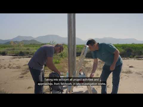
Video presented during the final event in Venice on June 2022, with Italian subtitles
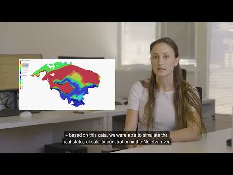
Video presented during the final event in Venice on June 2022, with Croatian subtitles


The final project event was held on 22nd June 2022 at Palazzo Grandi Stazioni (Veneto Region) in Venice. All the Project Partners participated in the final event as well as other technicians and representatives of institutions. The activities and results of the MoST project were illustrated.
Interviews about saltwater intrusion in Croatia and MoST project activities
Interviews about MoST project activities
Collection of presentations related to the project
General introduction
Zuccon - Majer
PUBLISHED ON 16/04/2020
PDF (0.82 Mb)
De Lucchi
PUBLISHED ON 16/04/2020
PDF (53.14 Mb)
Srzić
PUBLISHED ON 30/04/2020
PDF (7.8 Mb)
Racetin
PUBLISHED ON 30/04/2020
PDF (8.05 Mb)
Zancanaro
PUBLISHED ON 07/05/2020
PDF (9.18 Mb)
Gasparetto - Salandin
PUBLISHED ON 16/04/2020
PDF (6.19 Mb)
Scientific meeting and visit to the Italian pilot site
Botto - Castagna
PUBLISHED ON 18/02/2022
PDF (9.92 Mb)
Zancanaro
PUBLISHED ON 18/02/2022
PDF (17.02 Mb)
Lovrinovic
PUBLISHED ON 18/02/2022
PDF (4.49 Mb)
Srzic
PUBLISHED ON 18/02/2022
PDF (6.38 Mb)
Matic
PUBLISHED ON 18/02/2022
PDF (3.58 Mb)
Racetin
PUBLISHED ON 18/02/2022
PDF (3.98 Mb)
Documents and tools of the project
Smartphone app prototype for real-time surveillance of saltwater concentration in the Venice sites and Web-tool for data storing and querying.
The MoST App (developed for Android systems only) will allow to take under control and check constantly the behaviour of the main hydrological parameters acquired by the monitoring network established in the Venice site.
The same address (most.dicea.unipd.it) will be used as the address of a website to store graphical information developed within MoST and to store, query, and download the dataset with the main hydrological parameters acquired by the monitoring network established in the Venice site (i.e., the dataset that can be “only” visualized through the MoST App). The website will be accessible by any browser.
Web and mobile phone application to enable the real time insight of the surface and groundwater parameters in the Croatian sites.
Croatian project partners developed and released a web and mobile phone application to enable the real time insight of the surface and groundwater parameters as piezometric head, temperature, electrical conductivity.
The idea of App development relies on the fact to make those data accessible to land users, farmers, citizens, stakeholders and other target groups interested in this product. In general, App can be used in both ways, as a web and mobile application and does not require any kind of login, thus making those data public.
Initially, it can be either used as a web tool which provides information on sensor locations and available data sets. Otherwise, it can be downloaded to smart phones and operated as a mobile App. App is developed to be used in either English and Croatian language so the user has to pick between those two options.
Reports on the visit tours and on the final conferences
Metkovic_June 2021
PUBLISHED ON 08/11/2022
PDF (3.08 Mb)
Chioggia_October 2021
PUBLISHED ON 04/11/2022
PDF (4.61 Mb)
Dubrovnik_Metkovic_June 2022
PUBLISHED ON 23/11/2022
PDF (3.92 Mb)
Venice_June 2022
PUBLISHED ON 10/10/2022
PDF (3.35 Mb)
Collection of leaflets and posters about the project
Short project portrait_2019- EN
PUBLISHED ON 15/04/2020
PDF (3.1 Mb)
Short project portrait_2019- IT
PUBLISHED ON 15/04/2020
PDF (3.1 Mb)
Folder for MoST Project
PUBLISHED ON 28/02/2022
PDF (1.65 Mb)
Short project portrait_2021
PUBLISHED ON 01/07/2021
PDF (1.21 Mb)
Short project portrait_2021
PUBLISHED ON 28/02/2022
PDF (0.63 Mb)
MoST poster A3
PUBLISHED ON 15/04/2020
PDF (0.76 Mb)
MoST poster 700x1000
PUBLISHED ON 15/04/2020
PDF (1.19 Mb)
MoST rollup
PUBLISHED ON 15/04/2020
PDF (3.77 Mb)
Playbill used during the Infoday on 06/12/2019
PUBLISHED ON 15/04/2020
PDF (0.74 Mb)
CNR Rollup
PUBLISHED ON 25/11/2020
PDF (23.31 Mb)
Printed publications about the Project
Final technical publication ENG
PUBLISHED ON 10/10/2022
ZIP (84.09 Mb)
Final technical publication ITA
PUBLISHED ON 10/10/2022
ZIP (90.46 Mb)
Brochure_Croatian project area
PUBLISHED ON 10/10/2022
PDF (10.64 Mb)
Collection of scientific papers
WP2.3.3_Scientific papers
PUBLISHED ON 10/10/2022
PDF (0.37 Mb)
Deliverables as foreseen by the Application Form: Work Packages n. 3 - n. 4 - n. 5
D 3.1.1_Report on the geomorphological setting of the Italian site
PUBLISHED ON 16/11/2022
PDF (3.22 Mb)
D 3.1.2_Report on the geomorphological setting of the Croatian site
PUBLISHED ON 10/11/2022
PDF (1.88 Mb)
D 3.1.3_Report on the initial hydrogeological and agricultural conditions of the Italian site
PUBLISHED ON 17/11/2022
PDF (5.08 Mb)
D 3.1.4_Report on the initial hydrogeological and agricultural conditions of the Croatian site
PUBLISHED ON 10/11/2022
PDF (22.93 Mb)
D 3.1.5_Report on the final hydrogeological and agricultural conditions of the Italian site (after the realization of the mitigation interventions)
PUBLISHED ON 10/11/2022
PDF (1.32 Mb)
D 3.1.6_Plan of the groundwater and surficial water monitoring networks of the Italian site
PUBLISHED ON 17/11/2022
PDF (9.34 Mb)
D 3.1.7_Plan of the groundwater and surficial water monitoring networks of the Croatian site
PUBLISHED ON 10/11/2022
PDF (4.09 Mb)
D 3.1.8_Project of the interventions to mitigate saltwater contamination in the Italian site
PUBLISHED ON 22/11/2022
PDF (1.63 Mb)
D 3.2.1_Establishment and setting up of the lab equipments
PUBLISHED ON 22/11/2022
PDF (2.33 Mb)
D 3.2.2_Report on the flume experiments: Italian tests
PUBLISHED ON 22/11/2022
PDF (2.94 Mb)
D 3.2.3_Report on the flume experiments: Croatian tests
PUBLISHED ON 07/11/2022
PDF (4.84 Mb)
D 3.2.4_Report on the soil physics on samples collected in the Italian site
PUBLISHED ON 17/11/2022
PDF (2.75 Mb)
D 3.2.5_Report on the soil physics on samples collected in the Croatian site
PUBLISHED ON 07/11/2022
PDF (9.22 Mb)
D 3.2.6_Report on the water quality on samples collected in Italian site
PUBLISHED ON 22/11/2022
PDF (0.7 Mb)
D 3.2.7_Report on the water quality on samples collected in Croatian site
PUBLISHED ON 07/11/2022
PDF (2.73 Mb)
D 3.3.1_Database on groundwater and surficial water level, temperature and electrical conductivity, meteo-climatic conditions, sea level, pumping station activity in the Italian monitoring area
PUBLISHED ON 17/11/2022
PDF (1.74 Mb)
D 3.3.2_Database on groundwater and surficial water level, temperature and electrical conductivity, meteo-climatic conditions, sea level, pumping station activity in the Croatian monitoring area
PUBLISHED ON 07/11/2022
PDF (1.23 Mb)
D 3.3.3_Report on the evolution of the hydrogeological, meteo-climatic, and crop parameters in the Italian site over the project time span
PUBLISHED ON 17/11/2022
PDF (2.03 Mb)
D 3.3.4_Report on the evolution of the hydrogeological, meteo-climatic and crop parameters in the Croatian site over the project time span
PUBLISHED ON 07/11/2022
PDF (19.23 Mb)
D 3.4.1_Report on the groundwater and transport flow model application to the flume experiment in Italy lab
PUBLISHED ON 22/11/2022
PDF (2.41 Mb)
D 3.4.2_Report on the groundwater and transport flow model application to the flume experiment in Croatian lab
PUBLISHED ON 07/11/2022
PDF (2.67 Mb)
D 3.4.3_Report on the groundwater and transport flow model application to the to the Italian field site
PUBLISHED ON 18/11/2022
PDF (10.84 Mb)
D 3.4.4_Report on the groundwater and transport flow model application to the to the Croatian field site
PUBLISHED ON 07/11/2022
PDF (6.28 Mb)
D 3.4.5_Report on the model application to evaluate the efficiency of mitigation strategies for the selected scenarios of climate changes
PUBLISHED ON 22/11/2022
PDF (6.47 Mb)
D 4.1.1_Input for the characterization and the numerical model: 3D hydro-geophysical setting of the Neretva plain in dry/salt and wet/fresh hydrologic conditions
PUBLISHED ON 07/11/2022
PDF (6.37 Mb)
D 4.1.2_Report on the test results
PUBLISHED ON 07/11/2022
PDF (2.48 Mb)
D 4.1.3_Proposed actions and/or pilot solutions for salt water intrusion mitigation tested in laboratory and/or numerical model: report on procedures, analysed combinations, parameters and results
PUBLISHED ON 07/11/2022
PDF (6.77 Mb)
D 4.1.4_Decision upon recommendations and actions for salt water intrusion mitigation made: report on positive and negative effects of potential actions
PUBLISHED ON 07/11/2022
PDF (7.22 Mb)
D 4.2.1_A cut-off wall along the lagoon margin
PUBLISHED ON 22/11/2022
PDF (2.17 Mb)
D 4.2.2_A controlling system (gate, soil dam) on the mouth of the main irrigation channel
PUBLISHED ON 10/11/2022
PDF (1.41 Mb)
D 4.2.3_A sub-soil fresh-water distribution system using pipes located along a main sandy pale-channel
PUBLISHED ON 22/11/2022
PDF (5.29 Mb)
D 4.2.4_A report describing the infrastructure project and realization
PUBLISHED ON 22/11/2022
PDF (25.95 Mb)
D 5.1.1_Vulnerability map, including expected scenarios of climate changes
PUBLISHED ON 07/11/2022
PDF (4.28 Mb)
D 5.1.2_Guidelines with the actions related to the salt water intrusion mitigation developed
PUBLISHED ON 07/11/2022
PDF (3.17 Mb)
D 5.1.3_App for real-time saltwater values to be used by farmers and public authorities (in Croatian)
PUBLISHED ON 07/11/2022
PDF (1.74 Mb)
D 5.1.4_Web-tool for data storing and querying
PUBLISHED ON 10/11/2022
PDF (1.88 Mb)
D 5.2.1_Hydro-geo-morphological map of the study site
PUBLISHED ON 17/11/2022
PDF (70.11 Mb)
D 5.2.2_Vulnerability map
PUBLISHED ON 10/11/2022
PDF (1.76 Mb)
D 5.2.3_Guidelines on the crop production rules depending on salt concentration and farmland physical properties
PUBLISHED ON 10/11/2022
PDF (0.32 Mb)
D 5.2.4_Guidelines on planning infrastructure and irrigation strategies to contrast saltwater intrusion
PUBLISHED ON 10/11/2022
PDF (0.38 Mb)
D 5.2.5_App for real-time saltwater values to be used by farmers and public authorities
PUBLISHED ON 10/11/2022
PDF (0.78 Mb)
D 5.2.6_Web-tool for data storing and querying
PUBLISHED ON 10/11/2022
PDF (1 Mb)


Interviews about MoST project activities